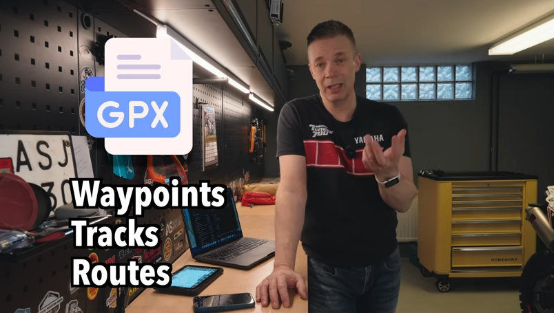
Mastering Adventure Ride Navigation: Syncing, GPX Files, Routes
 Robert Baldinger
left for contents
Embarking on adventure riding opens up a world of navigation possibilities that go far beyond simply punching in a destination on your GPS. It’s more than just turn-by-turn directions; it’s about routes, tracks, and sharing the plan with fellow riders.
If you’re new to the ADV scene, terms like GPX files and Trans Euro Trail downloads might sound like another language. But trust me, navigating this world is easier than you think, and in just a few minutes, you’ll be well on your way to becoming a navigation pro.
Here are three key things to keep in mind as we dive in:
- Syncing is your friend: Forget the hassle of manually transferring files between devices. Modern navigation apps offer seamless online syncing, letting you plan on your computer and ride with your phone or tablet without missing a beat.
- GPX is the universal language: Whether you’re sharing rides with friends using different apps or downloading epic routes like the Trans Euro Trail, GPX files are the key to compatibility and sharing.
- Routes vs. Tracks: Know the difference: Understanding the nuances between routes and tracks is crucial for effective navigation and choosing the right format for your adventure style.
If you’d rather watch this guide, here’s my original video on the topic:
Seamless Navigation Across Devices: The Power of Online Syncing
When you’re juggling a laptop for planning, a phone for quick checks, and maybe even a tablet for on-the-go navigation, device management can quickly become a headache. One of the first hurdles for anyone getting started is figuring out how to move those carefully crafted routes and trails from your computer to your phone, or vice versa.

Thankfully, there’s a simple solution: navigation apps with online syncing. These apps, and just about every navigation app these days, act like a central hub, automatically synchronizing your projects across all your devices. Think of apps like Stegra – some call it the “Spotify of navigation” – Locus Map, OsmAnd, and Calimoto. They all offer online planning tools that effortlessly sync to your devices. Even DMD is developing its own syncing capabilities.
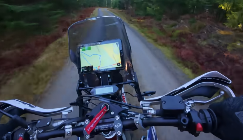
Let me show you how easy it is. Say I’m on my computer, planning a ride from my garage to a scenic spot, aiming for some adventurous gravel roads. I create my route in my chosen app, give it a name like “Garage Demo,” and save it.
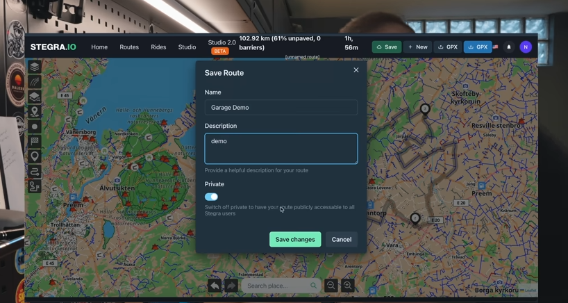
Now, I switch over to my phone, open the same app, and navigate to my routes. Lo and behold, there’s “Garage Demo,” ready to go. I can select it, and just like that, I’m ready to ride, with the route loaded and waiting.
The same magic happens on my tablet. Fire up the app, and “Garage Demo” is there again, ready for action. It’s truly “easy peasy” as I like to say. Plus, many of these apps let you create groups and collaborate with riding buddies on projects, making planning group rides a breeze.
GPX Files: The Universal Translator for Adventure Rides
While syncing apps are incredibly convenient, the reality is that not everyone operates within the same app ecosystem. Some of your friends might be die-hard Garmin users, while others prefer different apps. And then there’s the wealth of shared routes and tracks available online, like the legendary Trans Euro Trail. This is where GPX files become indispensable.
GPX stands for GPS Exchange Format. It’s essentially a universal file format designed for sharing GPS data between different devices and software. A GPX file acts as a container, holding waypoints, tracks, routes, and all the essential information about your trip in a way that any compatible device can understand.
Think of it as a common language that allows seamless communication between different navigation systems. GPX files are incredibly versatile and easy to share. You can send them via email, text message, or download them from websites. They can be imported and used on a wide range of devices, from Garmin units and tablets to computers and smartphones.
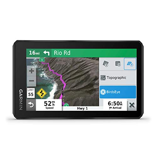
Rugged GPS with a bright 5.5” display, built for any adventure.
- Durable and weather-resistant (IPX7)
- Preloaded on-road and off-road maps
- Hands-free calling and live traffic updates
- Limited battery life at max brightness (but supports bike plug-in)
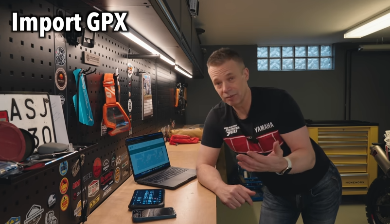
Importing GPX Files: Downloading Trans Euro Trail and Routes from Friends
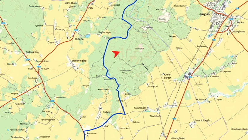
Let’s walk through importing GPX files, starting with downloading the Trans Euro Trail (TET). Head over to the Trans Euro Trail website, transeurotrail.org. Navigate to your desired section – in this case, Sweden – and download the relevant GPX file.
This download gives you a file, likely named something like “s.GPX,” containing all the waypoints and tracks for the Swedish TET.
Now, to get this into your navigation app, open your online planner, and look for an “import” function and select the downloaded GPX file.
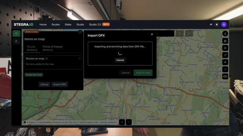
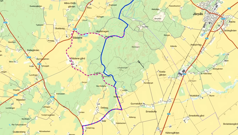
Since the TET GPX file can be quite large, give it a moment to load. Once imported, you can organize it within your app. I’ll add it to a collection named “TET Sweden” and display it on the map.
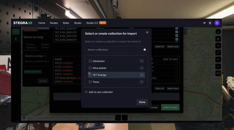
And now I’m set – the Trans Euro Trail Sweden, loaded and ready to explore. Having it in Stegra, or your chosen navigation app, means it’s now accessible on all your synced devices.
Importing a GPX file sent by a friend is just as straightforward. Let’s say a buddy emails you a ride file. The process is similar for text messages or other sharing methods.
Open the email, and you’ll see the attached GPX file. Instead of just clicking to view the file’s cryptic code, look for an “Open with” or “Share” icon, usually located in the lower corner on mobile devices.
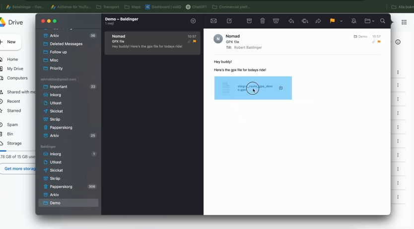
This will present you with a list of apps to open the GPX file with. If your navigation app isn’t immediately visible, scroll through the options. Select your app and it will import the track your friend shared.
Voila! The track from your buddy is now loaded in your app, ready for your next ride.
Transferring GPX Files to Devices Without Online Syncing: Google Drive to the Rescue
What if you’re using a device or app that doesn’t yet offer online syncing, like DMD2 (though they are actively working on it!) or other systems? For Android devices, Google Drive provides a handy workaround.
On your computer, access Google Drive – which I have installed across all my devices. Simply drag and drop the GPX files you want to transfer into your Google Drive storage. This could be the “Ride Buddy” file, the Trans Euro Trail GPX, or any other route you want on your tablet.
Since Android is deeply integrated with Google Drive, accessing these files on your tablet is seamless. In your navigation app – DMD2 in this example – navigate to the GPX import section. Look for an option like “Load File,” which should directly access your Google Drive.
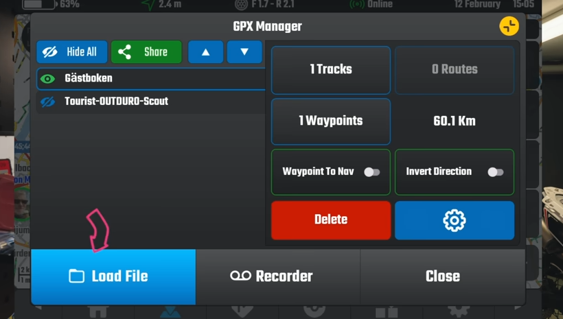
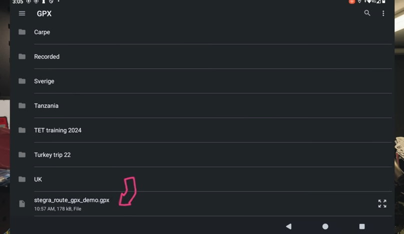
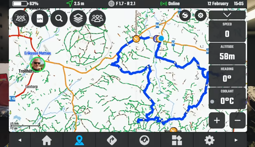
Within Google Drive, locate the GPX folder and select the file you want to load – in this case, the Stegra route. Tap to load it, and the GPX track will appear on your map.
You can then customize the track’s appearance – I’ll change the color to blue for better visibility. And just like that, the GPX file is on your tablet, ready for your ride.
This Google Drive method is a reliable way to transfer GPX files to Android devices, particularly useful for apps that don’t yet have built-in syncing.
Sharing Your Rides: Exporting GPX Tracks
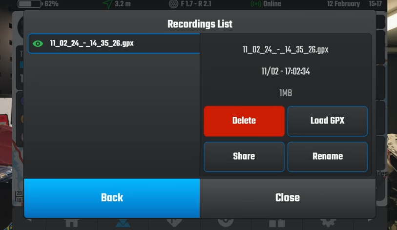
Now, let’s flip the script and look at sharing your own epic rides with friends. Most navigation apps allow you to record your rides, creating a track of your journey.
Once you’ve finished recording a ride, you’ll typically find it saved within your app. In Stegra, for example, after ending a recording, your ride appears as a saved track.
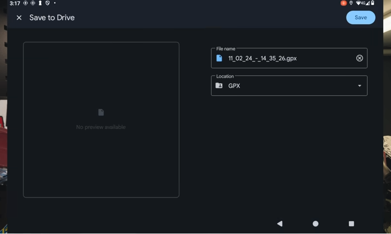
To share this ride as a GPX file, look for a “Share” or “Export” button. Selecting this option usually allows you to save the track to your Google Drive.
Choose your GPX folder in Google Drive and save the file there. Now, your ride is saved as a GPX file on Google Drive, ready to be shared. You can easily send it to friends via email or share a link.
Alternatively, if you’ve saved your ride as a project within your navigation app, you can typically export it as a GPX file directly. In Stegra, you can find your saved projects, select the ride you want to share – like the “GPX Demo” – and choose the “Download GPX” option.
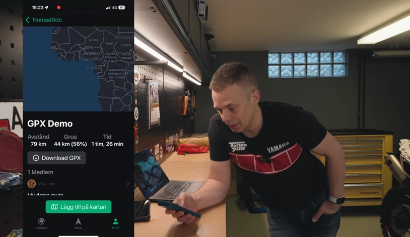
The app will then prompt you to choose how you want to share the GPX file – email, messaging apps, and more are usually available options. Sharing your rides in GPX format is incredibly easy.
Routes vs. Tracks: Understanding the Key Differences
So, we’ve covered creating, importing, and sharing routes and tracks using apps and GPX files. But it’s essential to understand the fundamental difference between a route and a track, as this impacts how you navigate.
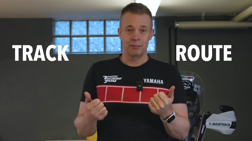
A route is what you’re likely familiar with from car GPS navigators or apps like Google Maps. It relies on a map and a navigation engine. You set a destination, and the navigator calculates a route based on the map data, considering roads and available paths.
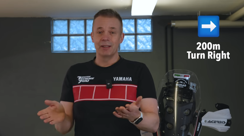
Because a route uses map information, it can provide turn-by-turn directions, guiding you along roads and paths known to the map.
In contrast, a track is essentially a digital breadcrumb trail of where someone has actually been. Tracks are typically recorded during a ride or journey at set intervals – say, every second – capturing GPS location points and timestamps.
Tracks don’t rely on a map for navigation instructions. Instead, a track is simply a series of GPS points plotted on a map. Many GPX files you download, especially for adventure riding, are tracks.
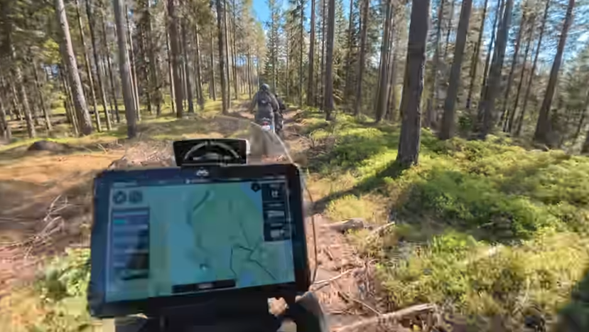
When you load a track onto your navigation device, it appears as a line overlaid on the map – like drawing a line on a paper map. You see your current location in relation to the track line. If you deviate from the track, you’ll see yourself moving away from the line and need to find your way back to it.
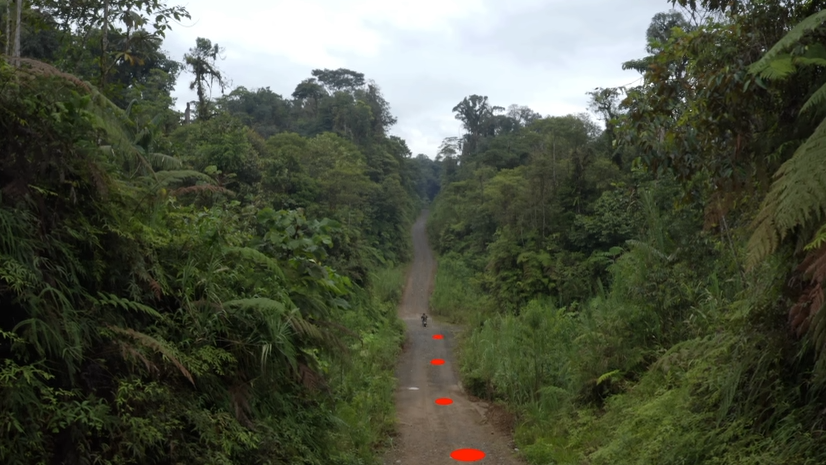
For adventure riding, especially on routes like the Trans Euro Trail, I often prefer navigating with tracks. I don’t necessarily need turn-by-turn instructions; the track provides a guide, and I enjoy the freedom to explore within the general path.
It’s worth knowing that some apps and Garmin devices offer the option to convert a track into a route. This attempts to generate turn-by-turn directions from a track.
However, because a track is simply a recording of where someone went, it might go off-road, across fields, or even across water where there are no mapped roads. When displayed on a map, the track accurately shows the path taken, regardless of mapped roads.
But when you convert a track to a route, the navigation software uses its map data to create a route that approximates the track, but it will follow mapped roads and trails.
So, if you convert a Trans Euro Trail GPX track – which often includes off-road sections and deviations from standard roads – into a route for turn-by-turn navigation, the converted route might differ slightly from the original track. It might try to stick to recognized roads and trails, potentially missing some of the intended off-road or more adventurous sections of the original track. You might not be riding exactly where the original track intended.
Hopefully, this has clarified the basics of adventure riding navigation, GPX files, and the crucial difference between routes and tracks. If you were a complete beginner to all of this, I hope you now feel a lot more confident navigating the digital side of adventure riding. Thanks for tuning in!